|
Wind &
Weather
|
Weather
affects us all, but none more than the sailor. Every time he
ventures onto the sea, he knows it is out there waiting for him.
The best he can do is try to understand his foe and prepare himself
for the worst.
|
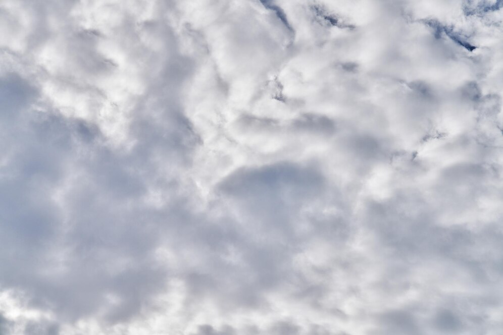
Basic Cloud Formations
|
 |
 |
 |
 |
|
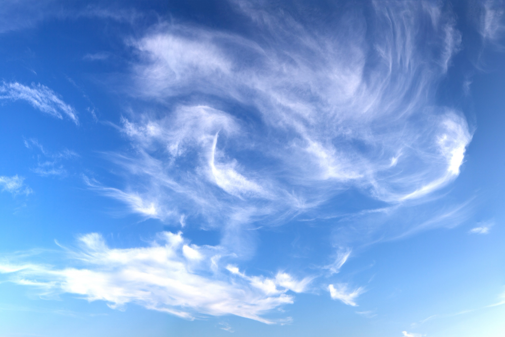
Cirrus
Image by onlyyouqjon Freepik |
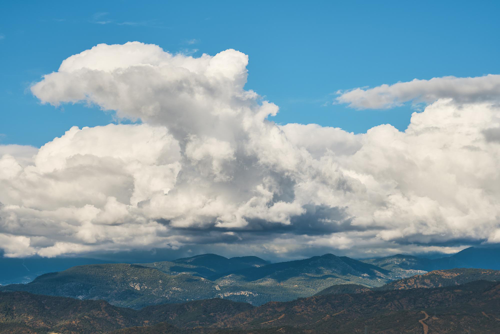
Cumulonimbus
Image by ededchechine on Freepik |
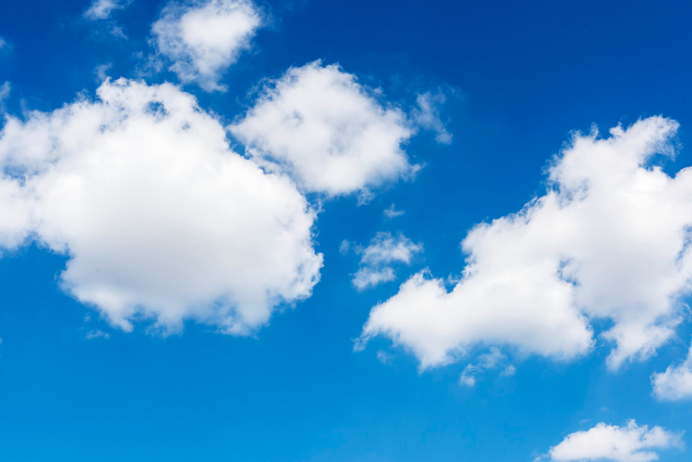
Cumulus
Image by rawpixel.com on Freepik |
Stratus
Image by krakenimages.com on Freepik |
Clouds
are defined by their general appearance and level in the atmosphere.
A
prefix is frequently given to the cloud name to indicate the level of the
atmosphere in which it resides.
Cirro
is the prefix given to high clouds, those with bases above 20,000 feet.
Alto is the prefix given to mid-level clouds, those between 6,000 and
20,000 feet.
Nimbo added to the beginning or nimbus added to the end of a cloud name
means the cloud is producing precipitation.
The
system is by no means uniform. There is no term for low clouds, and there
are some odd joinings, such as stratocumulus, which is a cloud with two
different shapes.
So
here's how some cloud types stack up:
|
Cloud
Type
|
Appearance
|
Altitude
|
|
Cumulonimbus
|
Thunderheads
|
Near
ground to above 50,000 feet
|
|
Cirrostratus
|
Thin,
wispy, above thunderheads
|
Above
18,000 feet
|
|
Cirrus
|
Thin,
often with "mare's tail"
|
Above
18,000 feet
|
|
Cirrocumulus
|
Small
puffy clouds
|
Above
18,000 feet
|
|
Altostratus
|
Thin,
uniform, sometimes with "wide wale corduroy"
appearance
|
6,000
- 20,000 feet
|
|
Altocumulus
|
Medium-sized
puffy clouds
|
6,000
- 20,000 feet
|
|
Stratocumulus
|
Broad
and flat on the bottom, puffy on top
|
Below
6,000 feet
|
|
Cumulus
|
Puffy
clouds
|
Below
6,000 feet
|
|
Stratus
|
Uniform,
thick to thin layered clouds
|
Below
6,000 feet
|
|
|
Highs & Lows
|
Winds blow clockwise
around a high pressure area in the northern hemisphere and veer outward.
(Winds rotate counterclockwise In the southern hemisphere.)
Winds blow
counterclockwise around a low pressure area in the northern hemisphere and veer inward.
(Winds rotate clockwise in the southern hemisphere.)
The closer a high is to
a low, the closer the isobars and more wind is generated. |
|
| Standing
with you back to the wind, extend your arms to 10 o'clock and 4
o'clock. Your left arm will point to the low pressure area and you
right arm will point to the high pressure area in the northern
hemisphere. (In the southern hemisphere, the high is to your left
and the low is to your right.)
In days past, sailors
would use this simple technique to help guide them away from lows and
toward highs where they had a better chance of encountering more pleasant
weather conditions. It also aided them in running away from
hurricanes. |
|
Cold Fronts & Warm Fronts
|
Both cold front and warm
fronts bring with them rain, but the events leading up to the rain differ
slightly. The onset of each front is announced by different cloud
formations.
Northern
Hemisphere: Wind shifts
toward right (clockwise or veering) when either a warm or cold front
passes.
Southern
Hemisphere: Wind shifts left
(counterclockwise or backing) when either a warm or cold front passes.
Cold Front
Cold air replaces
warm air
Moves rapidly,
often signaled by towering cumulus clouds.
Rain, strong
winds, and thunderstorms.
Wind veers
clockwise as the front passes. |
Warm Front
Warm air replaces
cold air.
Moves slowly (1/2
speed of cold front).
Lots of showery precipitation.
If air is
unstable, thunderstorms and strong winds are possible. |
Stationary Front
Air masses of
equal pressure opposing each other.
Doesn't move.
Weather similar to
warm front but less intense.
Winds
parallel the front. |
A
backing wind means storms are nigh;
Veering
wind will clear the skies. |
Mackerel skies and
mares' tails,
Mean high winds and
full sails. |
|
Squalls
|
Squalls have their own inherent
characteristics, two of which are heavy rain and strong winds.
They are fast moving and usually
short in duration. When
encountering a squall, it is often best to shorten sail in advance of its
approach and to batten down the hatches. |
|
Clouds & Wind
| Worsening
weather - Wind backs counterclockwise in the northern hemisphere
(clockwise in the southern hemisphere), and pressure drops.
Improving weather - Wind veers
clockwise in the northern hemisphere (counterclockwise in the southern
hemisphere), and pressure rises and stabilizes. |
High
and low clouds move in different directions:
Stand
with your back to the movement of the lower clouds.
A
change for the worse if the high clouds move left to right in the
northern hemisphere.
A
change for the better if the high clouds move right to left in the
northern hemisphere. |
|
Sound traveling far
and wide
A stormy day will
betide. |
Barometric Pressure Changes
|
A stationary barometer
indicates that current weather conditions are likely to continue.
A high and steady or
rising barometer indicates settled weather.
Lower than normal and
steady or a falling barometer indicates unsettled weather.
A rapid rise or fall
indicates that a strong wind is likely to blow and the weather is likely
to change.
The speed of a storm's
approach and its intensity will be indicated by the rate of barometric
fall and its amount.
If the barometer falls
without a change in weather, it's likely there is a violent storm a long
way off.
First rise after a
low,
Foretells a
stronger blow.
|
Rate
of Barometric Fall
A
fall of .01 inch per hour is considered a low rate.
A
fall of .03 inch per hour is considered a high rate.
A
fall of .10 inch is possible; .20 inch has been recorded.
Barometer
changes forecast 8-12 hours in the future. |
Barometric
Reading in the Middle Latitudes
29.60
inches is very low.
30.00
inches is average.
30.50
inches is high.
|
|
Hurricane
Season in the Caribbean, Gulf of Mexico, and U.S. East Coast
|
June: too soon
July: stand by
August: come it must
September: remember
October: all over
--Old weather saying |
Rainbows
A rainbow is created
by the refraction of sunlight in drops of rain in the air.
The center of the bow
is opposite the sun.
A rainbow in the
morning is to the west of the observer, and it is likely the rain that
created it will pass overhead.
A rainbow in the
afternoon is to the east, and the rain is likely to be moving away.
Rainbow to windward,
foul fall the day;
Rainbow to leeward,
damp runs away.
-- Old weather
saying
|
Dew on the Deck
Dew in the morning
indicates fine weather ahead.
Heavy dew and hot
weather indicate continuing fine weather.
If there is no dew in
the morning and the previous day was hot, rain is likely.
When halo rings the
moon or sun,
Rain's approaching
on the run.
-- Old weather
saying
|
Wind Speed
Less
than 1 knot – smoke rises vertically
1-3
knots – smoke drifts
4-6
knots – wind felt on face
7-10
knots – light flag extends from pole
11-16
knots – wind raises dust, cinders, loose paper, etc.
17-21
knots – flag waves and snaps briskly
22-27
knots – wind whistles in the rigging
28-33
knots – walking against wind is difficult
34-40
knots – wind impedes progress
When
water is very cold and air is warm (e.g. spring mornings), wind speed at
the mast head won't match wind speed at the water.
White
caps will form with the wind speed reached 12 knots. |
Beaufort
Wind Scale
|
Force
Number |
Speed
in knots |
Description |
| 0 |
0-0.9 |
Calm |
| 1 |
1-3 |
Light
air |
| 2 |
4-6 |
Light
breeze |
| 3 |
7-10 |
Gentle
breeze |
| 4 |
11-16 |
Moderate
breeze |
| 5 |
17-21 |
Fresh
breeze |
| 6 |
22-27 |
Strong
breeze |
| 7 |
28-33 |
Near
gale |
| 8 |
34-40 |
Gale |
| 9 |
41-47 |
Strong
gale |
| 10 |
48-55 |
Storm |
| 11 |
56-63 |
Violent
storm |
| 12 |
64+ |
Hurricane |
|
True Wind vs. Apparent Wind
The wind as it
naturally blows is called the "true wind."
The wind
you feel while sailing is referred to as the "apparent wind."
The
apparent wind is not from the exact same direction as the true wind
because of the wind generated by the forward motion of the boat.
The
apparent wind is always slightly forward of the true wind when underway. |
|
|
Land
Breeze
A land breeze is a
movement of air off the land onto the water that occurs after sunset as
the air cools over the land, sinks, and flows off the land onto the
warmer sea.
|
Sea
Breeze
A sea
breeze is a movement of air off the sea onto the land after sunrise as the
air heats and rises over the land, pulling the air onto the land off of
the cooler sea. |
Fog
Usually results
in visibility less than 1100 yards (i.e. approximately 1/2 mile or 1000 meters)
|
Radiation
Fog
Over land at night.
Caused by the ground
cooling the air below the dew point.
Usually not present
when there are high winds.
Usually burns off with
the morning sun.
|
Advection
Fog
Caused when
warm, moist air moves over cool land. Can
occur with heavy winds and in any season. Usually
persistent and prolonged. |
Sunsets
Bright
yellow - wind
Pale
yellow - rain
Pink -
Fair weather
If the sun goes pale
to bed,
'Twill rain
tomorrow, so 'tis said.
|
|